Log in
All resources
Create a design
38,808 Free Images of 1876 Maps
gerard valck
maps made in the 17th century
maps made in the 18th century
the comprehensive history of england (1876)
english-language maps showing history
1870s maps showing history
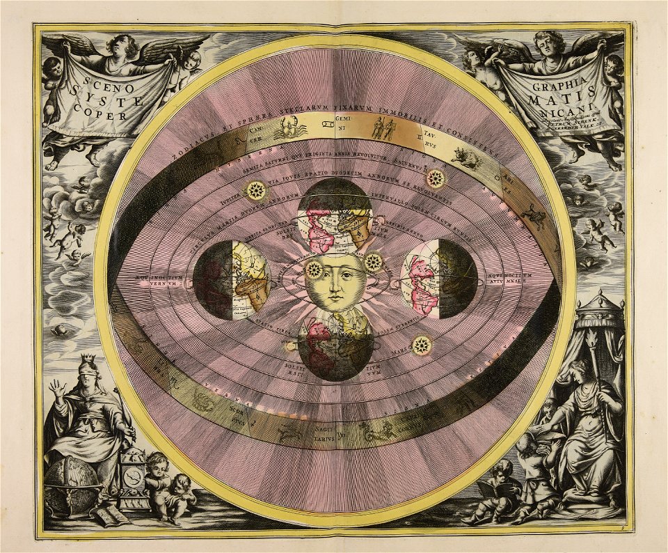
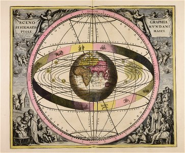
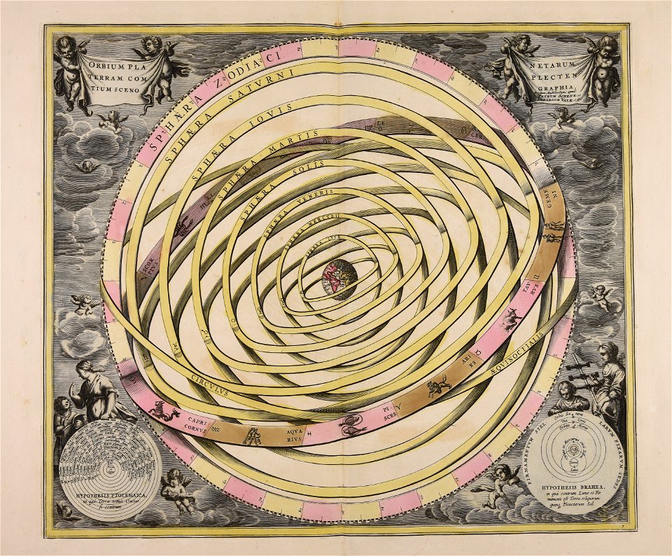
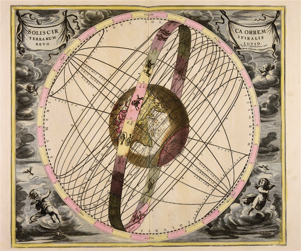
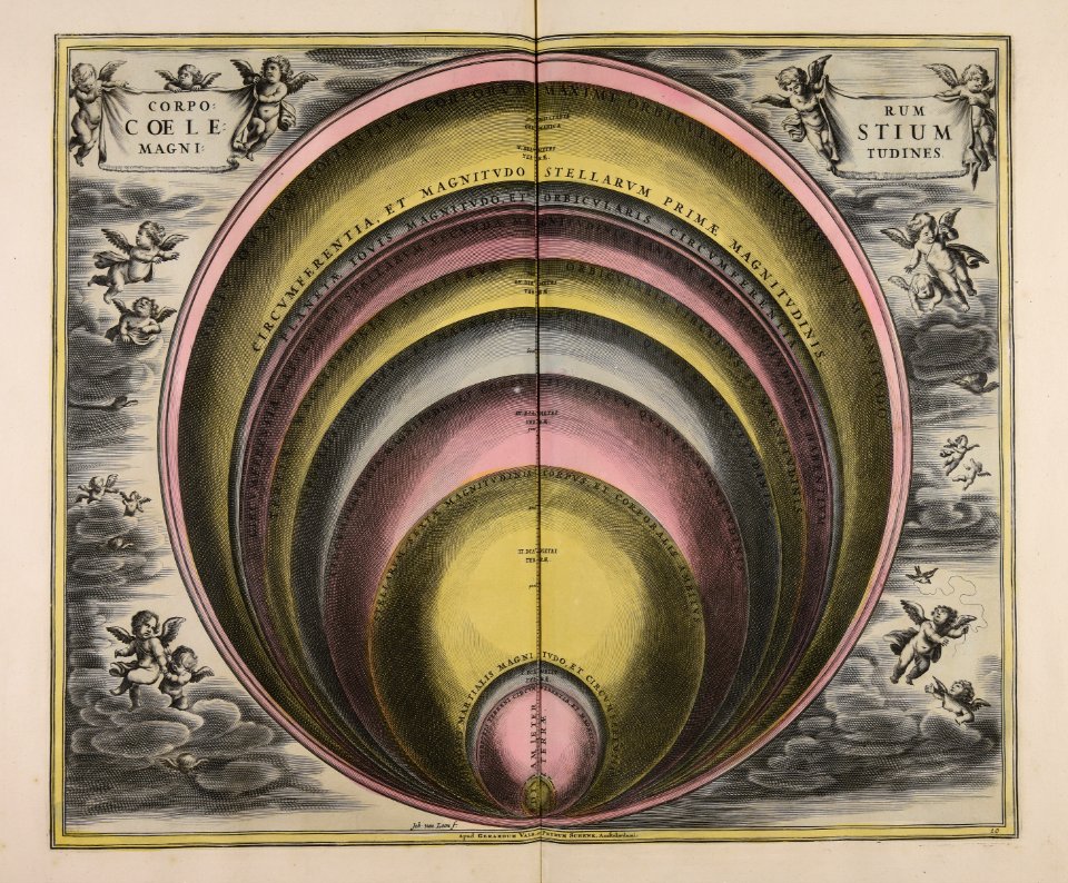
old celestial maps
cellarius harmonia macrocosmica
atlantis magni tomus primus (biblioteca comunale di trento)
pieter schenk (i)
charts and maps of the royal museums greenwich
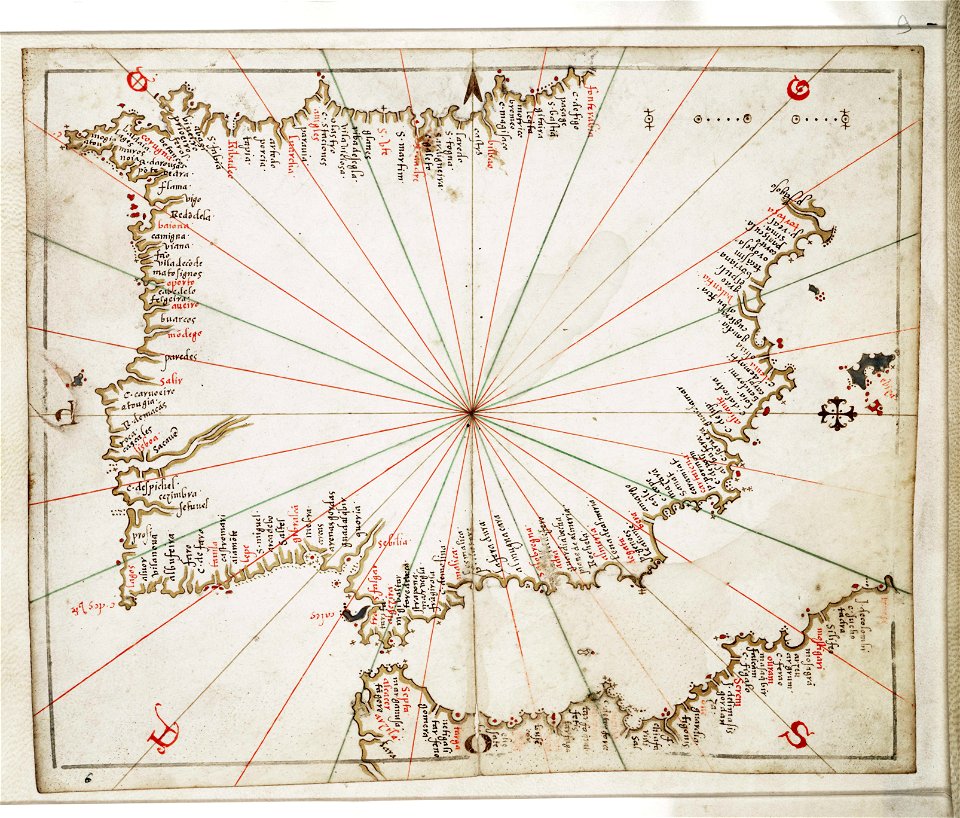
joan martines
old maps of stockholm by georg biurman
ulvsunda slott - park
engravings of topographia saxoniae inferioris
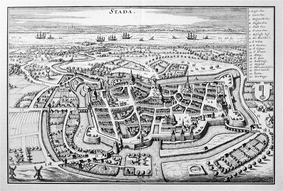
stadtbefestigung stade
bibliothèque municipale de reims
rès. g 152
1909 la ilustración española y americana
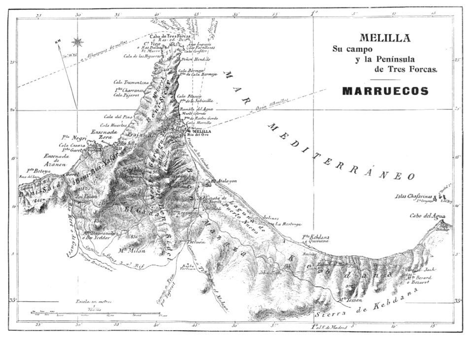
old maps of melilla
maps of liège in the 17th century
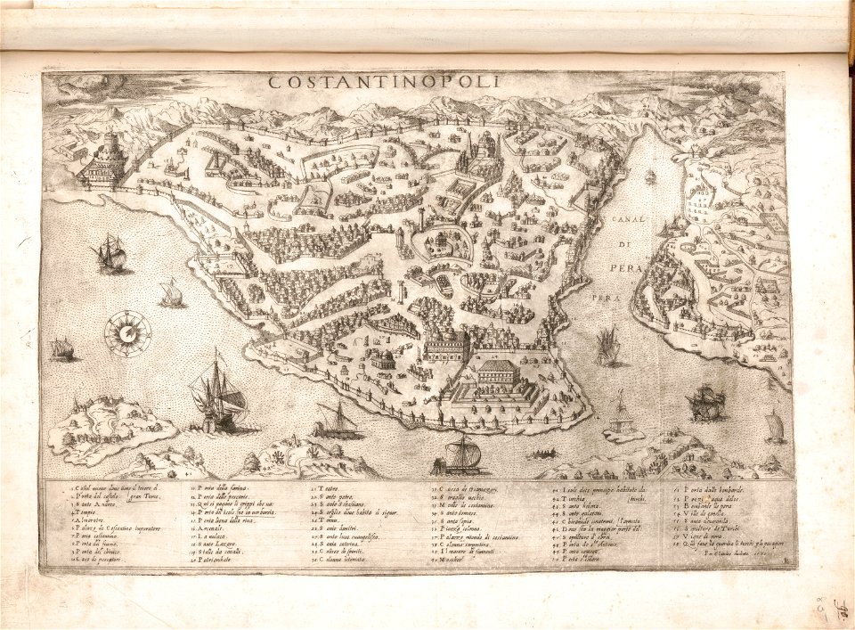
theatrum urbium (1610)
bibliothèque municipale de reims
rès. g 153
il devotissimo viaggio di gerusalemme fatto
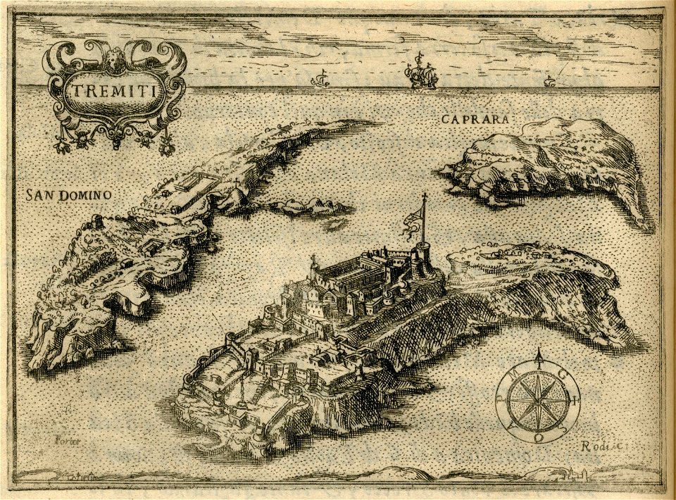
maps of isole tremiti
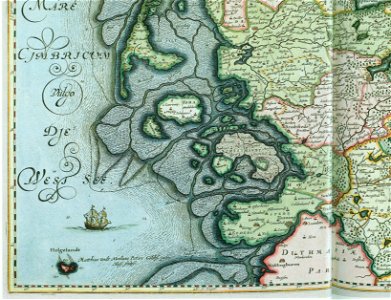
17th-century maps of schleswig-holstein
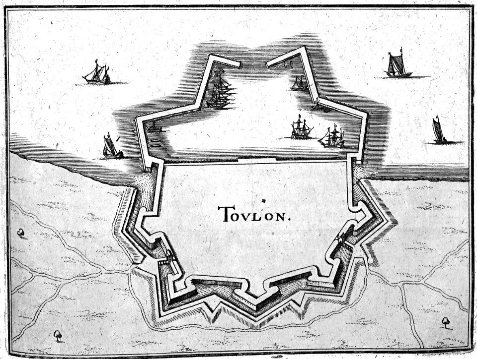
tönning
bibliothèque municipale de reims
rès. g 152
bibliothèque municipale de reims
rès. g 152
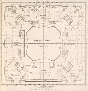
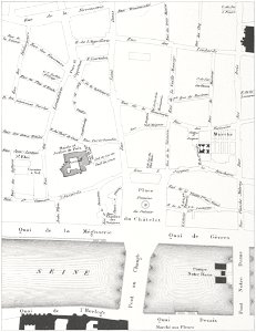
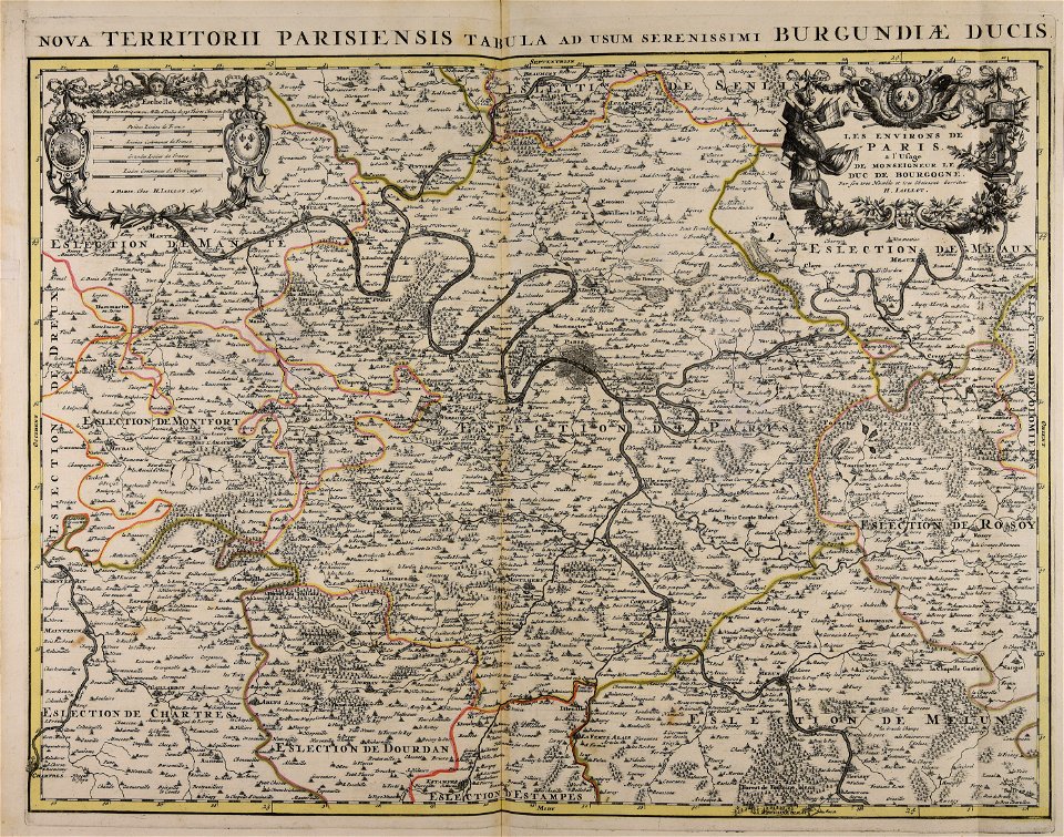
floor plans of paris
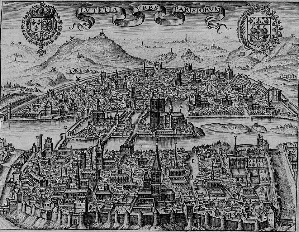
engravings of paris
volume 7 of le tour du monde
maps of nimrud
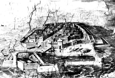
old maps of livorno
walls of livorno
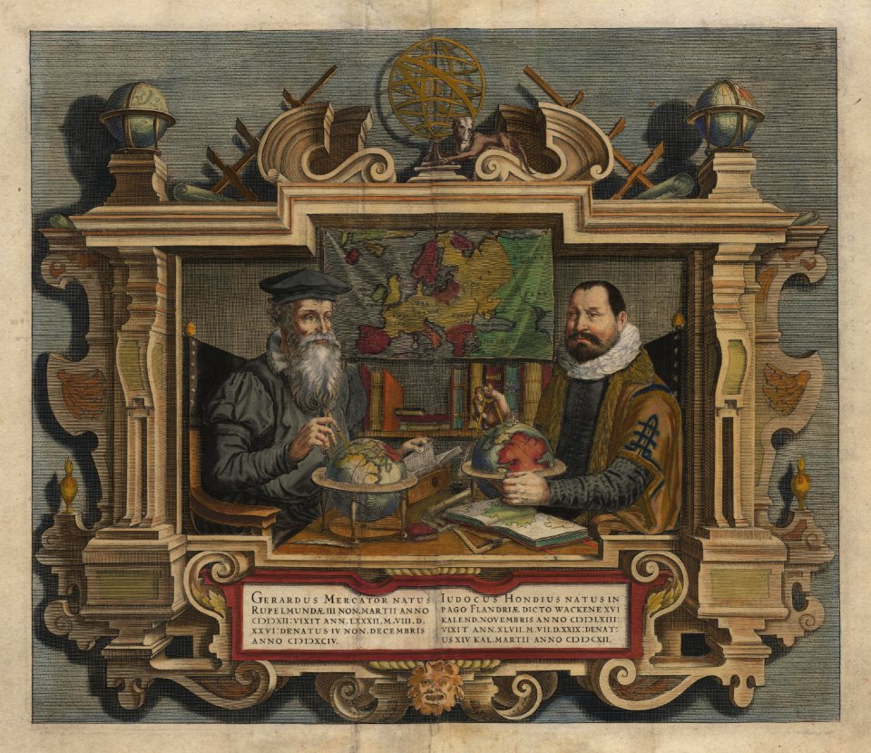
maps by gerardus mercator
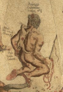
auriga in art
atlante veneto (raremaps.com) volume 2
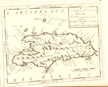
17th-century maps of hispaniola
the comprehensive history of england (1876)
english-language maps showing history
the comprehensive history of england (1876)
english-language maps showing history
the comprehensive history of england (1876)
english-language maps showing history
the comprehensive history of england (1876)
english-language maps showing history
history of siberia
alfred brehm
massachusetts
eastham
historical images of pont au change
lithographs of paris
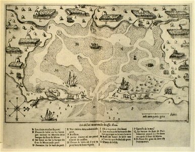
paris in the 17th century
claude chastillon
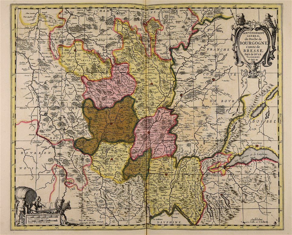
maps made in the 17th century
gerard valck
battles and leaders of the civil war (1887)
battle of ball's bluff
maps made in the 17th century
gerard valck
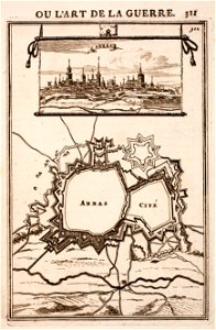
city walls of arras
history of arras
maps from the mechanical curator collection
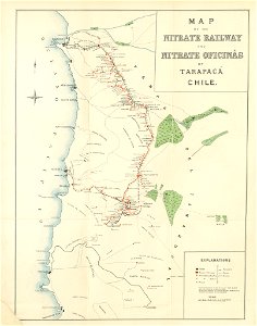
saltpeter works of chile
maps made in the 17th century
gerard valck
cornelis danckerts (i)
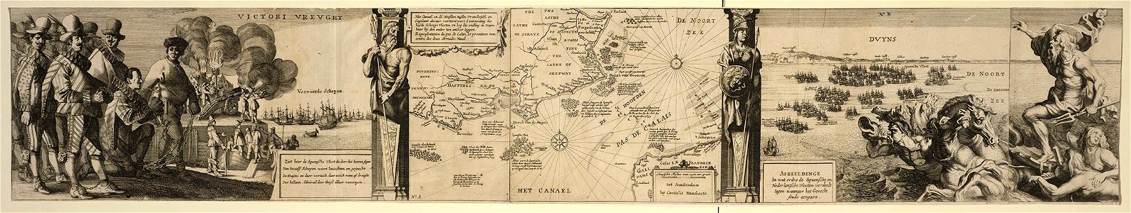
battle of the downs
maps made in the 18th century
gerard valck
maps made in the 18th century
gerard valck
maps made in the 17th century
gerard valck
maps made in the 18th century
gerard valck
maps by willem and johannes blaeu
old maps of groenlo
gerard valck
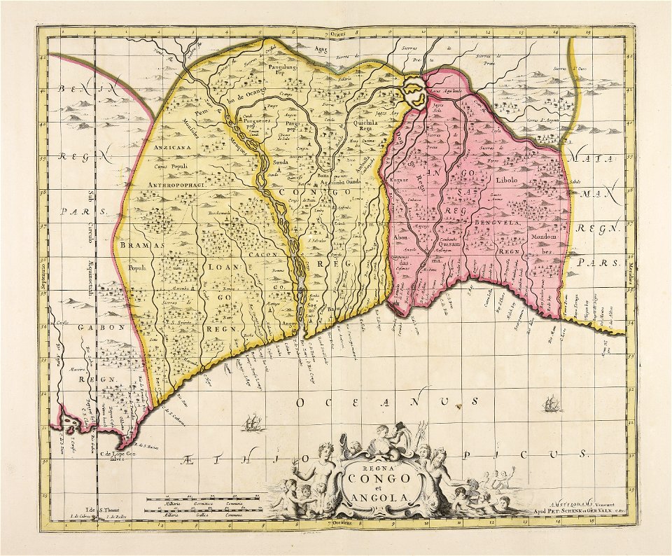
angola
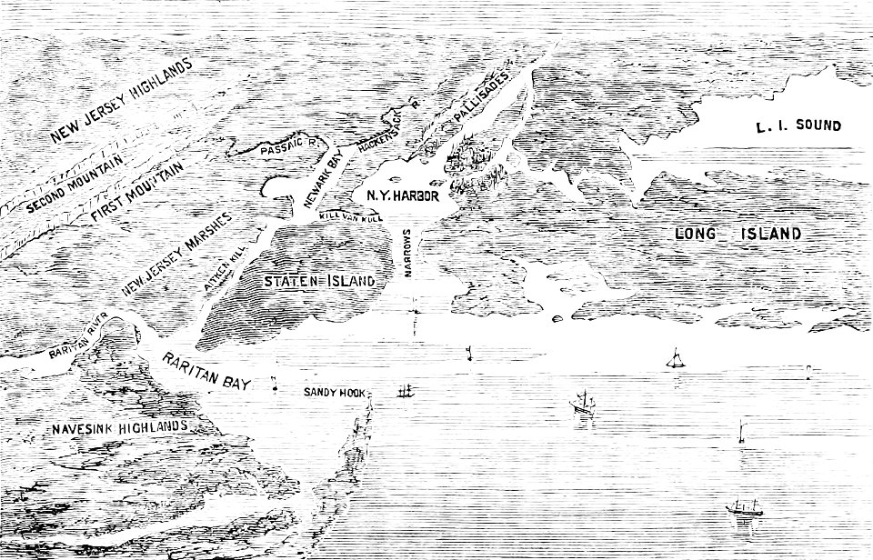
old maps of new york (state)
the palisades (hudson river)
maps made in the 18th century
gerard valck
maps made in the 18th century
gerard valck
1912 in rail transport in germany
enzyklopädie des eisenbahnwesens
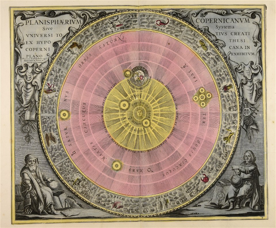
sistema solar
gerard valck
maps made in the 17th century
gerard valck
nouvelle géographie universelle, vol. xii
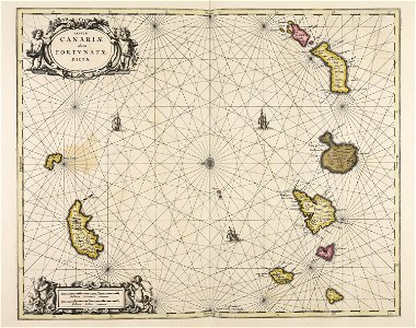
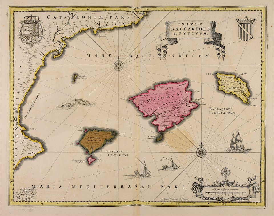
old maps of la gomera
the comprehensive history of england (1876)
english-language maps showing history
the comprehensive history of england (1876)
english-language maps showing history
africa and its inhabitants, vol. ii
charles eugène perron
the comprehensive history of england (1876)
english-language maps showing history
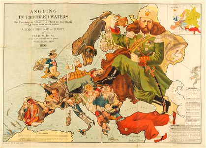
caricatures of wilhelm ii of germany
19th-century maps of europe
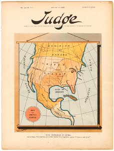
judge
1895
river
roads
color engravings
jodocus hondius
maps in the library of congress
ships on maps
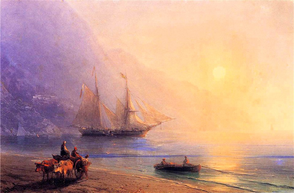
seacoasts by ivan aivazovsky
black sea in painting
albert bierstadt
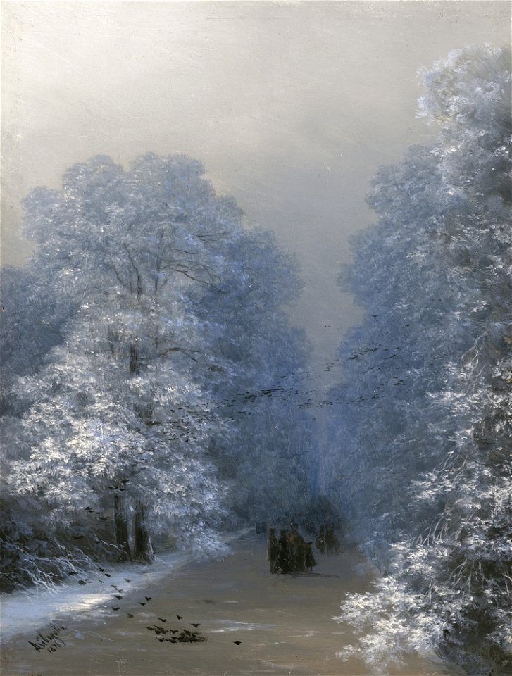
1876 paintings
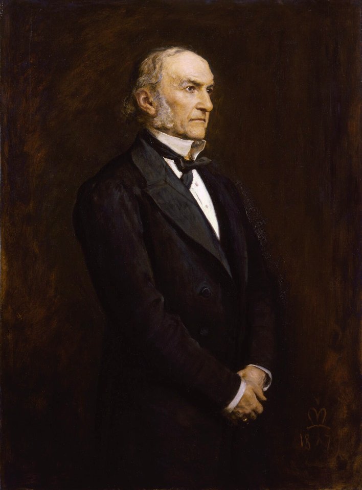
william ewart gladstone
william gladstone
1876 landscape paintings
trees in art
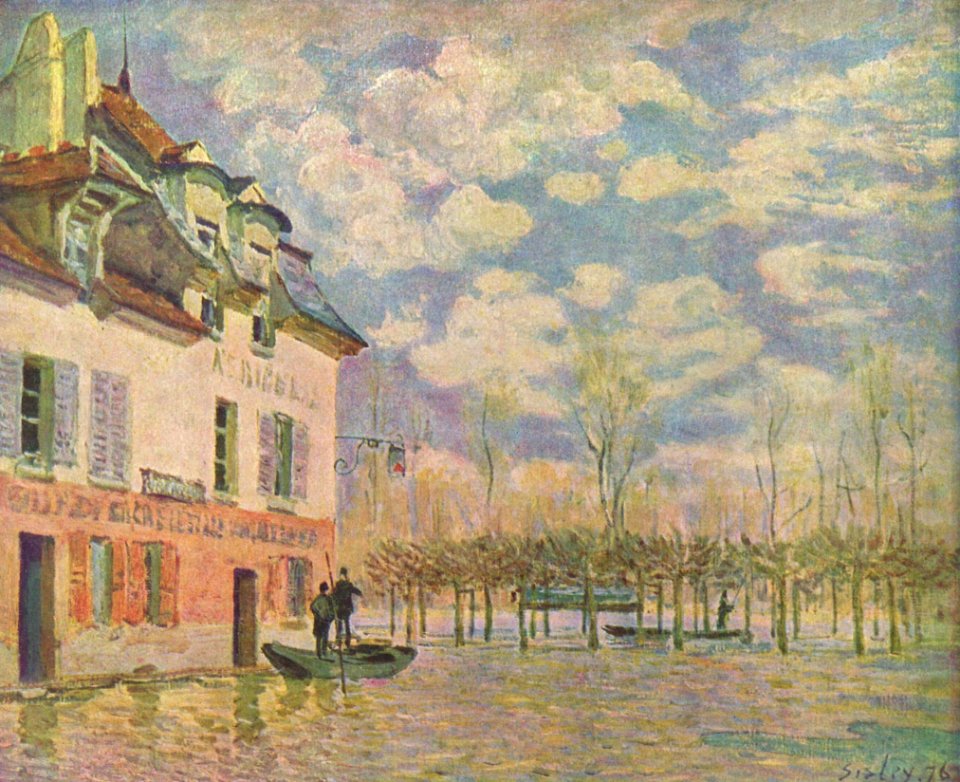
1870s paintings from france
people with boats in art
french paintings in the museum boijmans van beuningen
paintings of the seine in paris
1870s interiors in art
reading in art
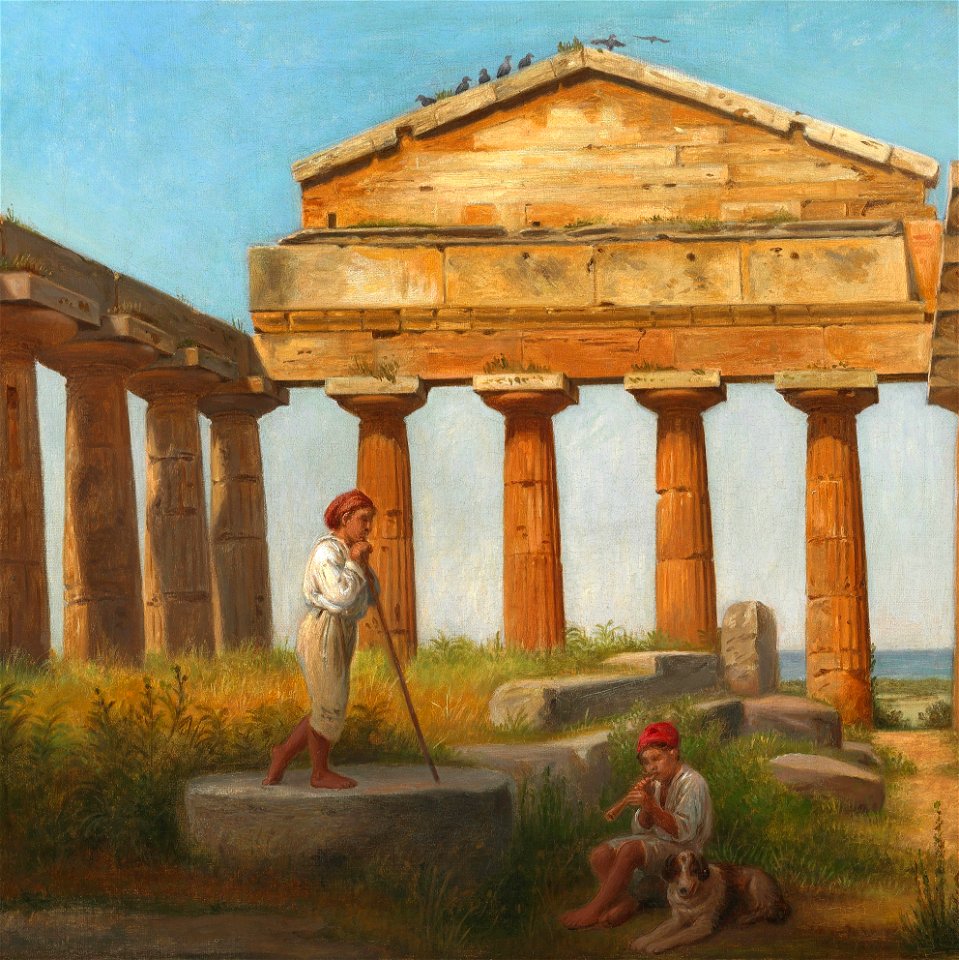
historical images of the temple of athena (paestum)
19th-century paintings of ruins
marché aux fleurs reine-elizabeth-ii
tribunal de commerce (paris)
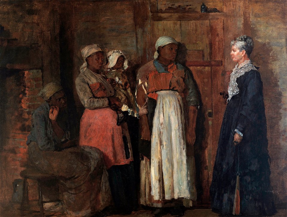
african american history of the 1870s
african americans in 19th-century art
oil paintings of lighthouses
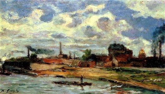
1870s landscape paintings
the comprehensive history of england (1876)
danube in 1704
géographie générale; physique, politique et économique (1876)
old maps of the pyrenees
géographie générale; physique, politique et économique (1876)
1870s maps of australia
géographie générale; physique, politique et économique (1876)
1870s maps of austria
géographie générale; physique, politique et économique (1876)
19th-century maps of java
the geographical distribution of animals (book)
1876 maps of europe
the geographical distribution of animals (book)
1876 maps of africa
diego gutiérrez
renaissance
the comprehensive history of england (1876)
english-language maps showing history
africa and its inhabitants, vol. ii
charles eugène perron
paintings in the musée des beaux-arts de nice
realism
history of antwerp
renaissance
cornell university library
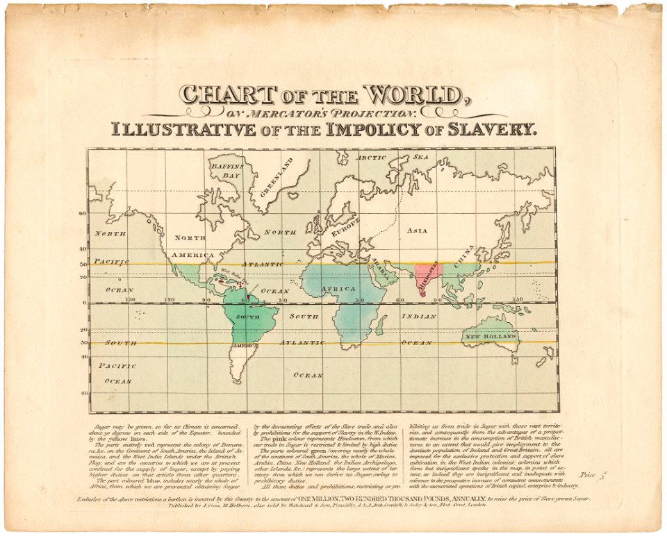
abolitionism
atlantis magni tomus quartus (biblioteca comunale di trento)
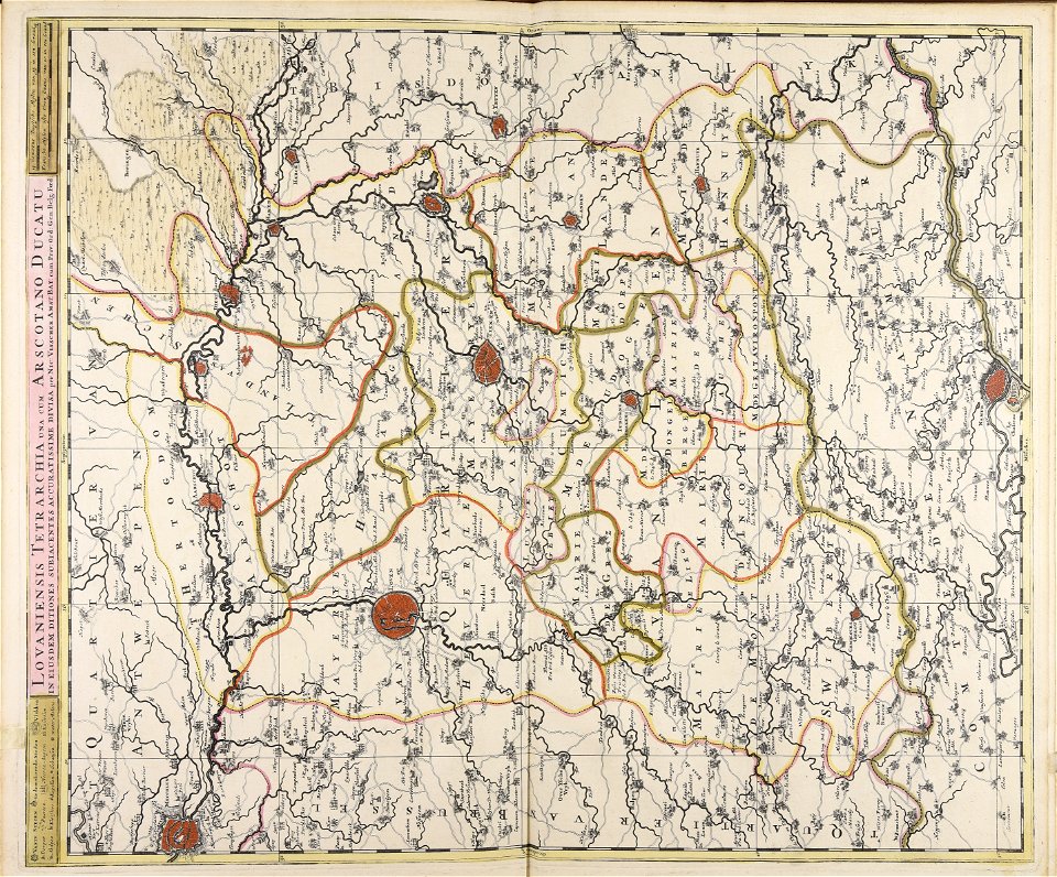
maps made in the 17th century
maps made in the 18th century
gerard valck
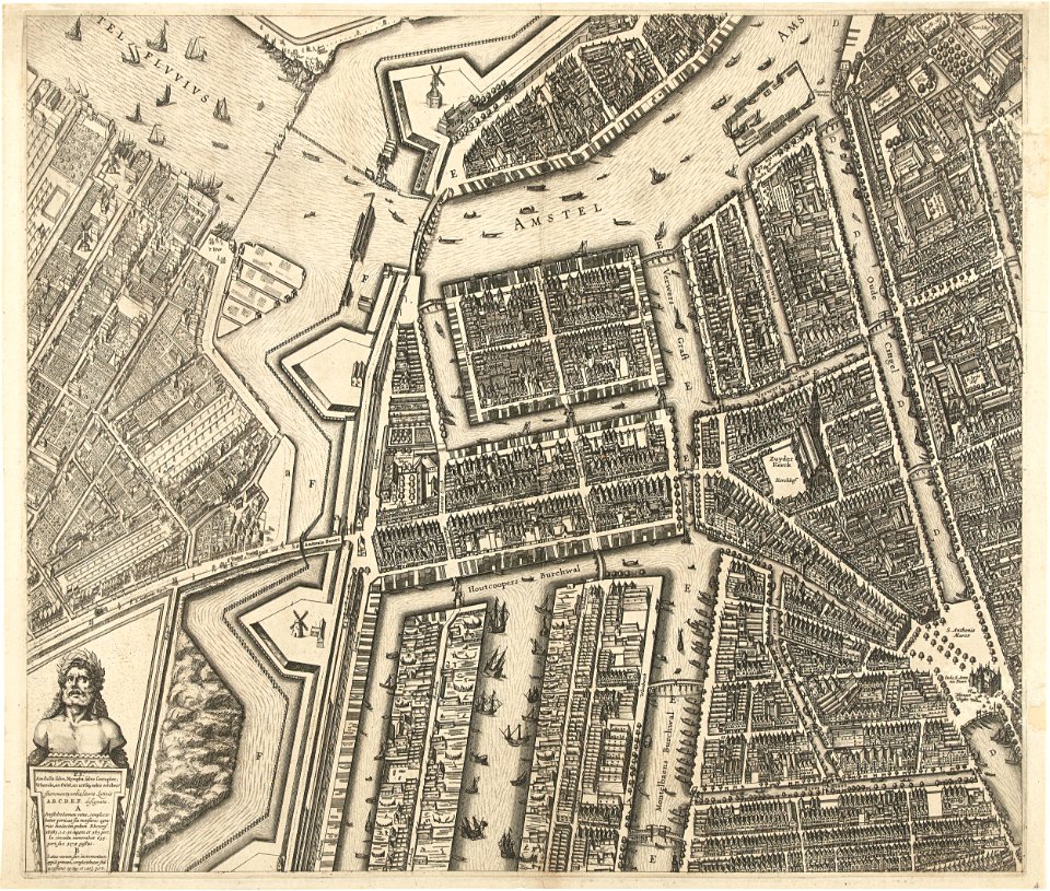
oudeschans
amsterdam
maps made in the 18th century
gerard valck
flemish 16th-century prints in the rijksmuseum amsterdam
maps of antwerp city walls
maps made in the 17th century
nicolaes visscher ii
maps of battles of the netherlands
hugh mackay (general)
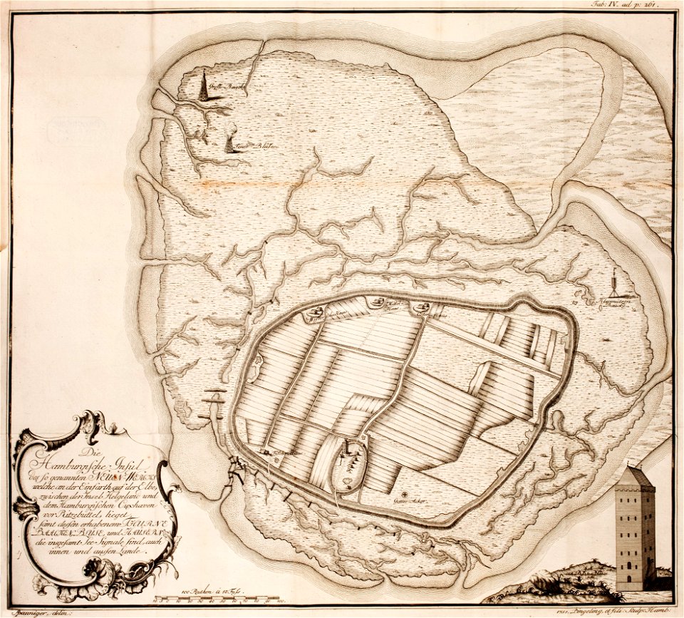
thomas albrecht pingeling
old maps of neuwerk
maps made in the 17th century
gerard valck
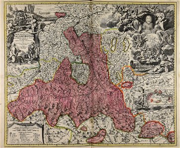
old maps of salzburg (state)
johann baptist homann
cornell university library
pictorial maps
maps made in the 18th century
gerard valck
posters by jules chéret
art nouveau
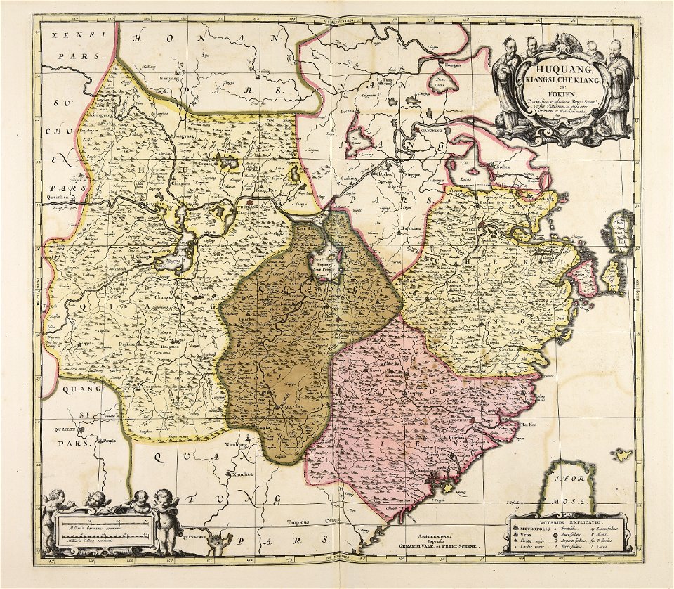
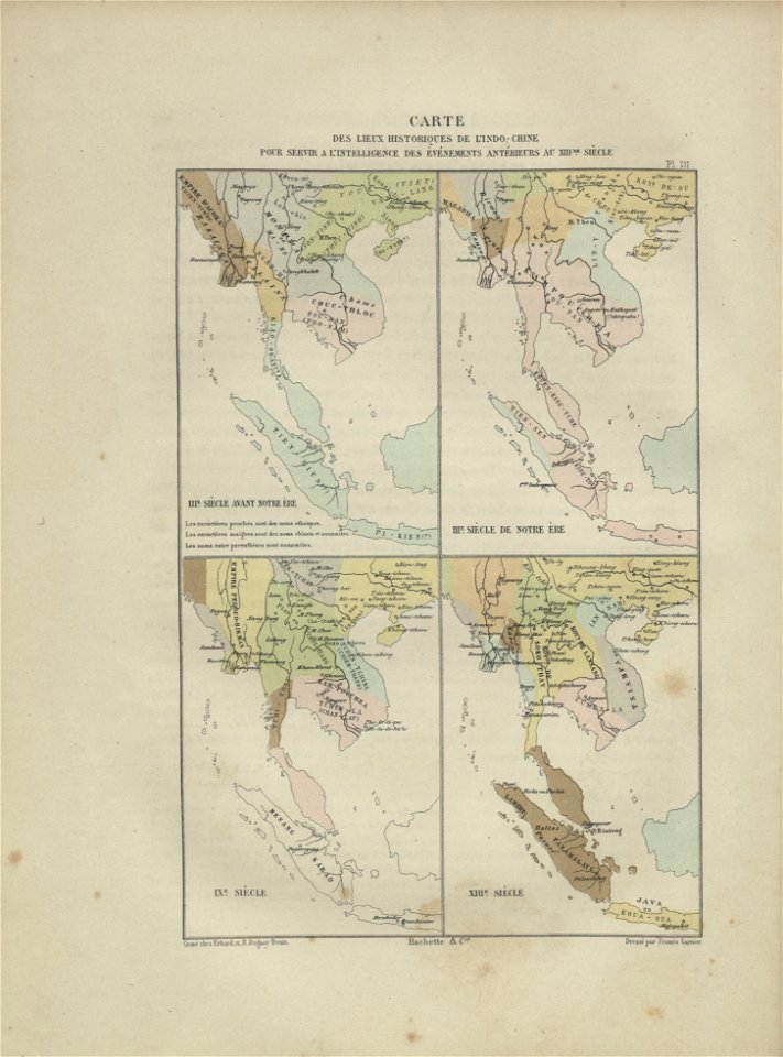
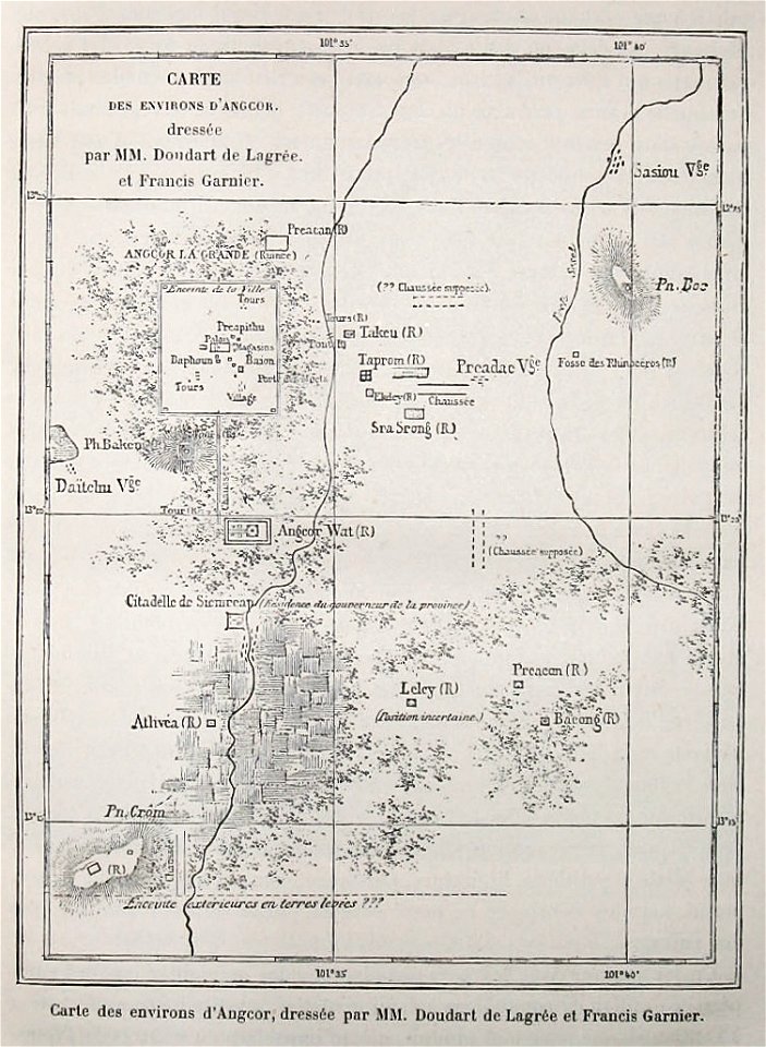
maps of indochina
francis garnier
voyage d'exploration en indo-chine - (1885
francis garnier
francesco piranesi
old maps of lazio
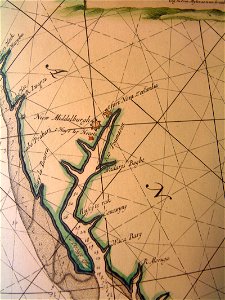
old maps of pomeroon
johannes van keulen
ducatus sleswicum sive justia australis
germany
old maps of the indian ocean
robert surcouf
old maps of the indian ocean
robert surcouf
maps and topographical views by joris hoefnagel
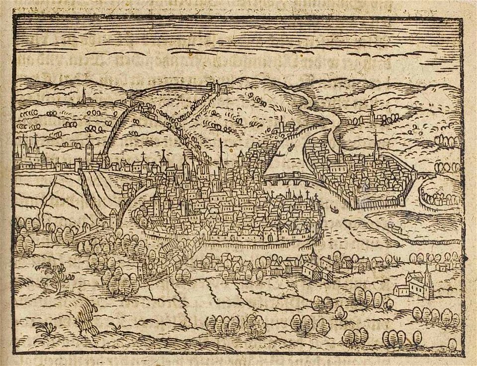
historical images of brno
engravings by matthäus merian
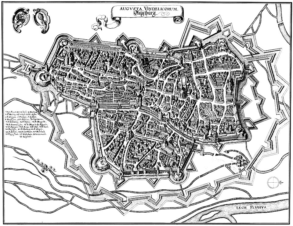
1640s maps of augsburg
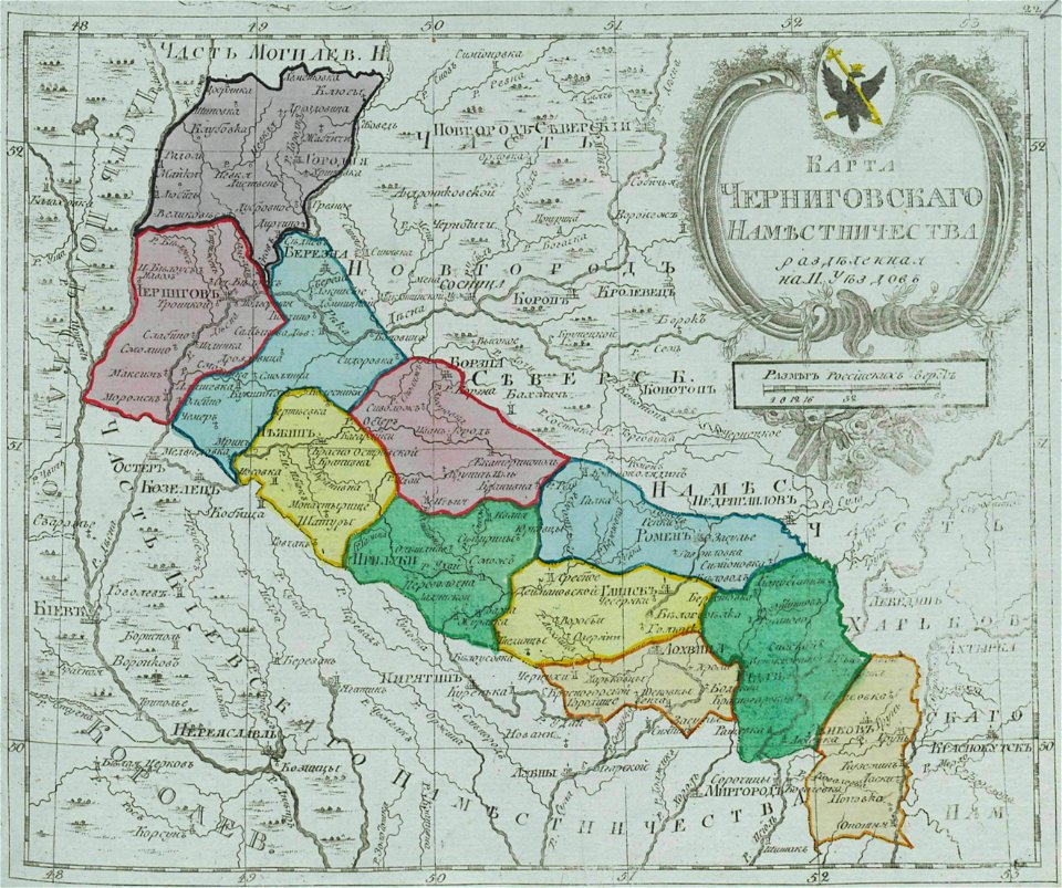
small atlas of the russian empire (1792)
maps of chernigov governorate
8901 - 9000 of 38,808
Next page
/ 389